
Walk a Miami-Dade Street
The Miami-Dade County street directory is built from address-keyed records, not one list of occupants. Start with a valid address. The Property Appraiser identifies the assessed owner, folio, legal description, and separate mailing address. e-Maps shows the parcel in relation to the street. Deeds establish recorded transfers. Public voter data and historical criss-cross volumes may identify some residents, but each omits large groups. Keep ownership and occupancy separate in every note.
- Validate and normalize the address, including direction and street type.
- Open Property Search and save the folio, owner, mailing address, and legal description.
- Select the parcel and nearby lots in e-Maps to work along the street.
- Follow the acquisition deed and prior grantors through Official Records.
- Add lawful voter evidence or a period criss-cross directory without claiming a full household.
Normalize Miami-Dade Street Addresses
The county's MARS validator accepts either a full address or parsed fields for house number, direction, street name, type, ZIP, and municipality. Its coverage goal is 99 percent, plus or minus one percent, for valid county addresses, ranges, and intersections. Preserve directional prefixes such as NW, SW, NE, and SE. Miami's grid makes those letters part of the address, not optional decoration.
A Miami postal label may describe an address in another municipality or unincorporated Miami-Dade. That distinction controls which office keeps permit and code files. MARS, the folio, and the map should agree before a city-specific request is sent. Old searches need one more check: Miami adopted a street renaming and numbering system in 1920, and separate cities use their own grids.
Miami-Dade Property Search by Street
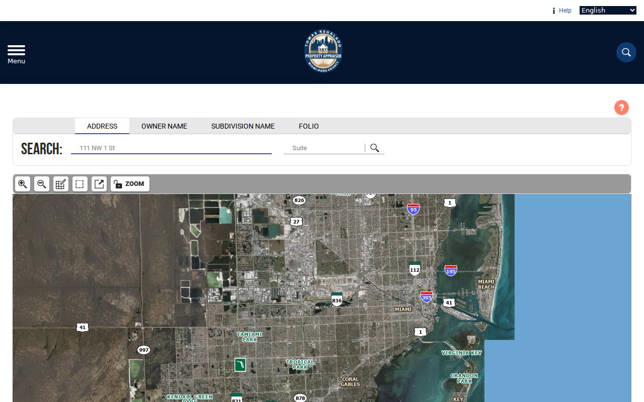
The free Property Appraiser search offers Address, Owner Name, Subdivision Name, and Folio modes. Address mode includes an optional suite field, which is vital for condominiums. Double-clicking a condominium complex on the map can show individual unit-owner entries. Partial results can be printed and moved into a spreadsheet for careful street-by-street work.
| Field | Format | Street use |
|---|---|---|
| Address | Normalized street address | Find the parcel |
| Suite | Optional unit | Narrow multi-unit results |
| Subdivision | Recorded plat name | Group related lots |
| Folio | 13-digit ID | Return to an exact parcel |
The parcel card can include owner, situs and mailing addresses, legal description, values, exemptions, sales history, dimensions, bed and bath count, aerials, and a sketch. The roll is continually edited and is not a title guarantee. Matching mailing and situs addresses or homestead status support owner occupancy, but do not identify every resident.
The captured Property Search screen shows its four principal modes.
Map a Miami-Dade Street Segment
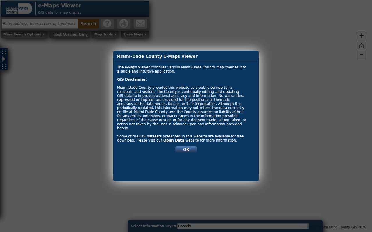
Miami-Dade e-Maps searches addresses, intersections, landmarks, folios, township-range-section, municipalities, and commission districts. Select Parcels as the information layer, then click one parcel or draw Select Area over a street segment. Street and aerial basemaps help orient the selection. Results can be browsed and exported to HTML or Excel.
The Buffer tool accepts a distance in feet and a target layer. It is useful for a reproducible parcel radius, while Select Area fits a hand-drawn block. Layers, measurement, and exports support research, but the county warns that map data may not be current or positionally exact. Use the folio and legal description as durable keys.
The parcel and street viewer is captured below.
Miami-Dade Street Records Compared
Several official record sets accept an address, folio, or parcel key. Together they form a practical street directory, but each describes a different event or role.
| Record Set | Keeper | What It Shows | Access |
|---|---|---|---|
| Tax roll | Property Appraiser | Owner, mailing and situs, folio | Free portal |
| Parcel GIS | County GIS | Parcels, aerials, districts, layers | Free viewer |
| Deeds and liens | County Recorder | Parties, legal description, transfer trail | Most 1974+ online |
| Voter extract | Elections | Nonexempt registered voters | Public-record route |
| Permits and cases | County or municipality | Work, inspections, violations, named parties | Portal or request |
The folio ties property, GIS, permits, and citations together. The legal description connects the parcel to deeds even if an address changes. Street name and ZIP organize voter data, but neither source proves every person at a home. For the modern address chain in depth, remain with official custodians and record the date of each search.
Deeds Along a Miami-Dade Street
The County Recorder indexes deeds, mortgages, liens, plats, judgments, releases, and related instruments. Start with the latest sale on a parcel card. Open that conveyance and record the grantee, grantor, CFN or book and page, recording date, and legal description. Search the seller as a grantee in an earlier period, confirming the same subdivision, lot, and block. Repeat for each parcel of interest.
The standard index is free and covers most documents from 1974 forward. Pre-1974 deeds did not vanish. The Records Library keeps all recorded copies and indexes and offers public computers, staff help, mail service, and searches by party, CFN, legal description, or book and page. Staff searches cost $2 per name per year. Copies are $1 per page plus $2 to certify.
Note: An address helps start a request, but party name, folio, legal description, CFN, and book-page are safer deed keys.
Miami-Dade Permits by Address
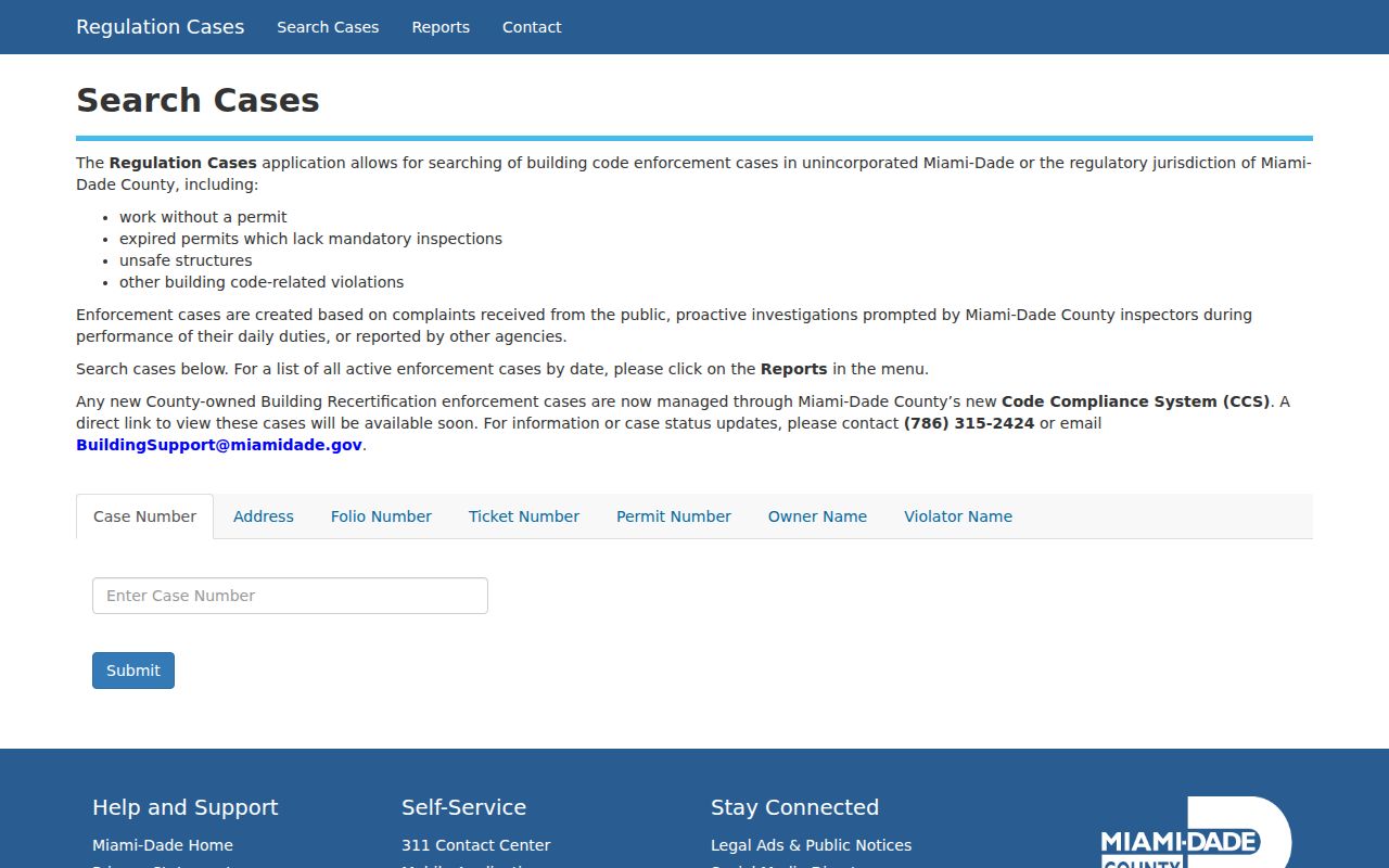
County building systems connect an address with permit applications, inspections, plans, certificates, and open work. The Regulation Cases viewer searches by case, address, folio, permit, ticket, owner, or violator. Short county-style input such as a house number, direction, numbered street, and street type works better than extra punctuation.
Regulation cases cover work without permits, expired permits, unsafe structures, and related issues in county jurisdiction. Code citations have their own address search. If the parcel lies inside a municipality, that city may be the keeper. County self-service indexes are free, while a formal open-permit search costs $43.75 and an enforcement-lien search costs $250.
The captured case-search screen shows the available address and identity fields.
Voters on a Miami-Dade Street
Florida public voter extracts can be grouped by residence street and ZIP under sections 98.095 and 97.0585, Florida Statutes. Miami-Dade Elections provides the local request route. The public file may include voter name, residence address, precinct, status, and registration dates, but exact fields should be checked against the current layout. The online status form is for checking one's own registration, not browsing other residents.
A voter list is never a household census. It omits minors, noncitizens, nonregistrants, and people protected by confidentiality rules. Social Security numbers, driver-license or state-ID numbers, signatures, and protected addresses are withheld. Active and inactive records reflect the extract period, so save the file date. Compare voter evidence with a parcel or deed only when lawful and relevant.
Earlier Miami-Dade Streets
A criss-cross directory arranges entries by street address instead of surname. It can identify a listed householder between census years, but it is not a modern resident roll. Miami-Dade Public Library System and HistoryMiami hold directories and other local-history sources. The full collection treatment belongs in the Miami-Dade city directory collections.
Miami's 1920 street renaming and numbering can make an address appear to disappear. Preserve the owner name, plat, subdivision, lot, block, and folio when moving across that change. Florida's 1935 and 1945 state censuses help bridge directory years, while federal public schedules currently run through 1950. Early Dade County also included areas now in Broward and Palm Beach, so period geography matters.
Miami-Dade Street Record Terms
The same terms recur across every by-address search. Keeping them distinct prevents a street directory from overstating what a record proves.
- Parcel
- A mapped unit of land identified in Miami-Dade by a folio.
- Situs address
- The physical location of the assessed parcel, distinct from the owner's mailing address.
- Plat
- A recorded map that divides a subdivision into lots and blocks.
- Criss-cross directory
- A historical volume arranged by address, often naming the listed householder.
The parcel and deed chain establish ownership. A directory entry or voter record may support occupancy for a specific date, but neither should be stretched beyond its stated population and coverage.
Limits of Miami-Dade Street Directories
No official Miami-Dade County street directory lists every person at every address. The tax roll centers on owners. Voter data cover registered, nonexempt voters. Recorded documents name parties to a legal event. Permits identify applicants, contractors, owners, or violators only when those roles appear. A matching owner mailing address and situs or a homestead exemption can support owner occupancy, yet neither reveals all household members.
Driver address data is restricted by Florida law and the federal Driver's Privacy Protection Act. Ordinary utility and delivery customer lists are not lawful substitutes for a public resident roll. Florida's Safe at Home program and other exemptions shield qualifying addresses. A missing address may reflect protection, a source's purpose, timing, or jurisdiction rather than absence from Miami-Dade County.
Lawful use. Miami-Dade address records are for legitimate personal research. Never use a street search to stalk, harass, intimidate, threaten, or harm anyone.